About Englishman Bay
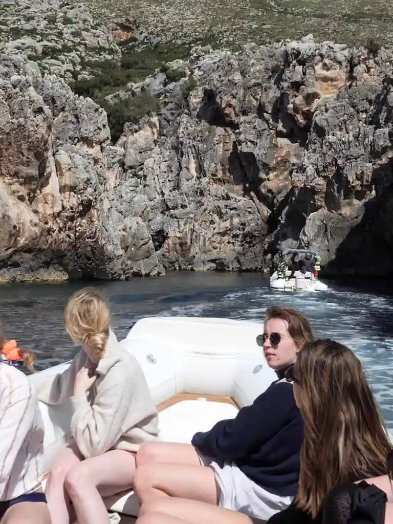
Englishman Bay is one of the more unusual stops on the Karaburun Peninsula — not because of its size or dramatic scenery, but because of how you get in. The bay itself is a small, naturally sheltered bay at the end of a narrow S-shaped corridor cut through the limestone rock. From the open sea, nothing about the cliffline suggests there is anything behind it. The entrance only becomes visible when the boat is close enough to see the gap, and even then the full extent of the passage is not apparent until you are inside it.
Once through the passage the inner bay opens up — calm water, high cliff walls on three sides, no buildings or infrastructure of any kind. The limestone walls reflect light into the water and the enclosed space keeps the surface sheltered even when conditions outside are rougher. It is a quiet, contained place with a quality of stillness that feels distinct from the open bays further along the coast.
The S-Shaped Passage
The entrance corridor is the defining feature of this location and the reason it appears on the route at all. The passage curves between two sections of rock, requiring the boat to adjust its line as it moves through. The walls on either side are close — close enough that the scale of the rock feels very immediate from a seat on the boat — and the passage is narrow enough that only smaller vessels can navigate it comfortably.
The S shape means that at no point during the approach is the inner bay visible from the outside. You enter the first curve, the rock closes in, you turn with the passage, and the bay reveals itself only at the second bend. It is a brief transit but an atmospheric one, and the contrast between the confined passage and the open space of the inner bay is part of what makes the stop memorable. The Canyon of Smugglers is also a narrow rock passage on the same full-day route — the two are similar in character but distinct in shape and scale.
WWII History & the Name
The name Englishman Bay is associated with Allied intelligence activity along the Albanian coast during World War II. During the German occupation of Albania, British and American operatives — including agents from the British Special Operations Executive (SOE) and the American Office of Strategic Services (OSS) — conducted covert missions along this coastline. The remote, concealed bays of the Karaburun Peninsula were useful for clandestine landings, supply drops and communication with local resistance groups operating in the area.
The exact details of what took place at this bay are not fully documented in sources widely available today, though the name has been in use among local fishermen and guides for decades. Contemporary accounts from wartime publications reference Allied maritime activity along this stretch of the Karaburun coast. The concealed S-shaped entrance would have made the location particularly suited to covert operations — a boat passing at a distance would have no reason to suspect anything lay behind the rock face.
Whether or not every detail of the local account is verifiable, the broader historical context is accurate: Allied agents did operate along the Karaburun coast during WWII, and the geography of these bays made them strategically useful for exactly the kind of activity the name implies.
Key Facts
A narrow S-shaped rock corridor, invisible from the open sea. The inner bay is only visible once you are through the second bend of the passage.
A small, naturally sheltered bay at the end of a narrow S-shaped passage through the limestone rock, with calm water, high walls on three sides and no development or facilities of any kind.
Associated with Allied (British and American) intelligence operations along the Karaburun coast during WWII. In use among local fishermen and guides for decades.
Clear and sheltered inside the bay. The enclosed position keeps the surface calmer than the open sections of the Karaburun coast nearby.
Part of the Karaburun-Sazan Marine National Park. No permanent development is permitted.
Only included on the full-day Grama Bay tour — one of eight stops on that route.
How to Visit
Englishman Bay is only accessible by boat and is included on our Grama Bay, Blue Cave & Haxhi Ali Cave full-day tour. It comes toward the later part of the route as the boat approaches Grama Bay from the north, after stops at Haxhi Ali Cave, the Secret Blue Cave, Dafina Bay and the Canyon of Smugglers.
The stop at Englishman Bay gives time to take in the passage and the inner bay. The snorkeling gear included on the full-day tour is available here, and the sheltered conditions inside the bay make it a good spot to use it.
Frequently Asked Questions
On the Karaburun Peninsula, approximately 1 hour by speedboat from Vlore. The entrance is not visible from the open sea and there is no road access.
The name is associated with Allied intelligence operations along the Albanian coast during WWII. British and American operatives used concealed coastal points along the Karaburun Peninsula for covert landings and coordination with local resistance groups.
The entrance to the bay runs through a narrow corridor in the rock that curves in an S shape between limestone walls. It is invisible from the open sea — the inner bay is only revealed once the boat is through the second bend of the passage.
The full-day Grama Bay, Blue Cave & Haxhi Ali Cave tour. It is one of eight stops on that route.
Between May and September when the sea is calm. The enclosed bay is sheltered even in moderate conditions, but calmer weather makes the passage through the S-shaped corridor smoother.